c. 8000 BCE
First Highlanders
Obsidian toolmakers scatter tens of thousands of blades across Eritrea's Asmara plateau, among the earliest highland occupations in the land.
Event 01Viewing
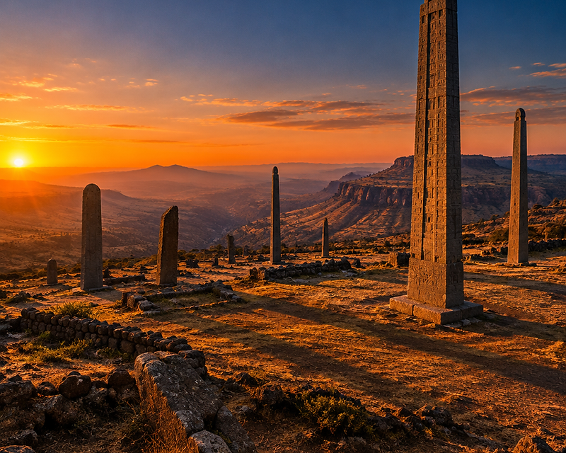
The Land of Punt · D'mt · Adulis · The Red Sea · The Aksumite Empire
A digital chronicle of the civilizations that rose in Eritrea, between the African highlands and the Red Sea — carved in obsidian, written in Ge'ez, and carried on the trade winds.
The Chronicle
c. 8000 – 2000 BCE
Stone-age toolmakers left tens of thousands of obsidian blades across the Asmara plateau. Cave paintings in the eastern escarpment record a pastoral life that predates the pyramids of Egypt by millennia.
c. 2500 BCE
Egyptian pharaohs dispatched fleets to a fabled land of gold, frankincense and myrrh. Ancient texts and modern archaeology converge on the western Red Sea coast — the land the Egyptians called Punt, Ta-Netjer, 'the God's Land'.
c. 800 – 400 BCE
The Kingdom of Dʿmt emerged as an early indigenous African kingdom in the northern Horn of Africa, centered around Yeha in present-day northern Ethiopia, with cultural connections extending into present-day Eritrea. Rooted in local highland traditions, Dʿmt developed its own political leadership, religious institutions, and monumental architecture. Although it maintained strong cultural and commercial ties with the Sabaeans of South Arabia, Dʿmt was not simply a South Arabian colony. Its rulers adopted and adapted foreign influences while preserving indigenous traditions. Its impressive stone temples and ancient inscriptions testify to the rise of a sophisticated African civilization centuries before the Kingdom of Aksum.
c. 100 BCE – 960 CE
Documented in the 1st-century Periplus of the Erythraean Sea, the port of Adulis on the Gulf of Zula funneled the empire's wealth to Rome, Arabia and India. Aksum minted its own gold coinage, raised enormous stone obelisks, and in its 6th-century heyday ruled a territory spanning modern Eritrea, northern Ethiopia, eastern Sudan, Yemen and southern Saudi Arabia — counted alongside Persia, Rome and China as one of the four great powers of its age.
c. 330 – 600 CE
King Ezana converted the realm to Christianity in the 4th century, among the earliest such adoptions in history. The Ge'ez script became the vessel of a literature that endures to this day in the Eritrean and Ethiopian churches.
c. 600 – 1000 CE
Worn down by the rise of Islam, shifting trade routes and environmental pressures, Aksum declined and Adulis slowly silted. The highland inheritance endured — in stone, in script, and in the faith of the people who remained.
c. 1135 – 1270 CE
As Aksum faded, the Eritrean highlands drifted beyond the reach of the Zagwe dynasty, which rose around Lalibela to the south and carved extraordinary rock-hewn churches into the living rock. Its decline gave way to the resurgent Abyssinian Empire, which pressed its old Aksumite claims on the highland peoples — Eritrea among them.
c. 1400 – 1550 CE
From the contested Red Sea coast emerged the Kingdom of Medri Bahri (ምድሪ ባሕሪ), meaning “Land of the Sea,” encompassing much of present-day Eritrea between the Red Sea and the Mereb River. For much of its history, Medri Bahri functioned as a largely independent, self-governing kingdom, ruled by its own monarch, the Bahri Negassi (King of the Sea). Although its rulers occasionally acknowledged the authority of Abyssinian emperors or entered into alliances with them, Medri Bahri maintained substantial political autonomy and frequently resisted outside interference. The Ottoman seizure of Massawa in 1557 introduced a new foreign power along the coast, but the Eritrean highlands largely remained beyond effective Ottoman control. Medri Bahri's history demonstrates that the territory of modern Eritrea possessed its own political institutions and traditions of self-rule centuries before European colonization.
Historical narrative adapted from research by Zantana
Scroll Through Time
Drag, scroll, or use the arrows to travel from Eritrea's obsidian toolmakers to the twilight of the Aksumite Empire.
Select an era for a detailed summary
Obsidian toolmakers scatter tens of thousands of blades across Eritrea's Asmara plateau, among the earliest highland occupations in the land.
Old Kingdom pharaohs dispatch fleets to a fabled land of gold, frankincense and myrrh. Ancient texts and archaeology converge on the western Red Sea coast.
Queen Hatshepsut sends a celebrated voyage to Punt, returning with living frankincense trees, ebony, gold and apes — recorded on the walls of her temple at Deir el-Bahri.
Settled farming communities emerge on the highland plateau, raising the first local stelae and laying the demographic foundations of later kingdoms.
A South Arabian-influenced kingdom centered near Yeha blends Sabaeans and indigenous Africans into a single highland civilization, building temples and inscribing monuments.
Local polities consolidate around Aksum and Matara, minting no coinage yet but already trading obsidian, ivory and tortoiseshell through the port of Adulis.
The Red Sea port of Adulis becomes a major emporium, linking the African interior to Egypt, Arabia and the wider Greco-Roman world.
The Aksumite kingdom erects monolithic obelisks — among them the largest single stones ever quarried in the ancient world — over royal tombs.
Aksum becomes the first sub-Saharan state to mint its own currency, issuing gold, silver and bronze coins bearing the king's name in Ge'ez.
King Ezana converts the realm to Christianity — among the earliest such conversions in history — and the Ge'ez script becomes the vessel of a new religious literature.
Aksumite armies march north and bring an end to the ancient kingdom of Kush at Meroë, extending the empire's reach along the Nile.
King Kaleb crosses the Red Sea to protect Christian communities in southern Arabia, briefly making Aksum a power on both shores.
The rise of Islam redirects Red Sea commerce toward the north. Adulis, the great port, begins a long, slow silting decline.
Aksumite power fades; the political center shifts south and inland. But the inheritance endures — in stone, in the Ge'ez script, and in the faith of the people who remain.
Swipe to explore
Side by Side
Choose any two eras from the timeline to read their cultural, linguistic and political differences side by side.
Era A
Era B
Date span
c. 8000 – 2000 BCE
c. 100 BCE – 600 CE
Cultural
Mobile bands of hunter-gatherers and early pastoralists worked volcanic glass into blades and scrapers. Cave paintings in the eastern escarpment record a pastoral life that predates the pyramids of Egypt by millennia.
Adulis flourishes as a cosmopolitan Red Sea emporium linking Africa, Rome, Arabia and India. Enormous monolithic stelae rise over royal tombs. Under King Ezana the realm adopts Christianity in the 4th century — among the earliest such conversions in history.
Linguistic
A pre-literate world — no writing survives. The period belongs to the ancestors of the Afroasiatic- and Cushitic-speaking peoples of the Eritrean highlands, whose traditions were carried entirely by mouth.
Ge'ez becomes the written language of state and faith; coinage is inscribed in Ge'ez, while Greek serves international inscriptions (Ezana's trilingual stelae). The Ge'ez script matures into a durable literary vessel.
Political
No centralized authority. Social life was organized around small, mobile kinship bands and pastoral groups; power was personal and customary rather than institutional.
A true empire: the first sub-Saharan state to mint its own currency, ruling modern Eritrea, northern Ethiopia, eastern Sudan, Yemen and southern Saudi Arabia. Aksumite armies end the kingdom of Kush at Meroë and campaign across the Red Sea in Himyar.
c. 2500 – 1493 BCE · The Land of Punt
Long before Aksum, before Adulis, before the kingdom of D'mt, the pharaohs of Egypt spoke of a fabled shore across the Red Sea — a place of gold, frankincense and myrrh they called Punt, Ta-Netjer, 'the God's Land'. For more than a thousand years Egyptian fleets sailed there, and modern scholarship places it on the western Red Sea coast — the very shores of modern Eritrea and eastern Sudan.
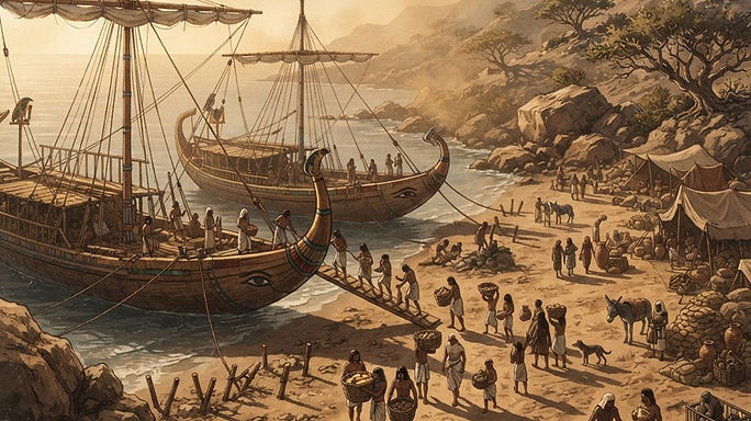
An Egyptian fleet moored on the coast of Punt — the western Red Sea shore of modern Eritrea.
Egypt's Old Kingdom records mention Punt as early as the Fifth Dynasty, around 2500 BCE, when the pharaoh Sahure sent an expedition returning with myrrh, electrum and a 'dwarf' of Punt. Middle Kingdom rulers continued the trade through the centuries that followed.
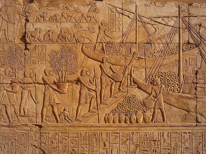
Hatshepsut's expedition to Punt, carved on the walls of her temple at Deir el-Bahri.
The most celebrated voyage came under the female pharaoh Hatshepsut, around 1493 BCE. Her fleet of five ships is recorded in vivid relief on the walls of her mortuary temple at Deir el-Bahri — the ships arriving in Punt, the chief's house raised on stilts, and the loading of frankincense trees uprooted and carried in baskets so they might be replanted on the Nile.
Where was Punt? For generations scholars debated. Today the evidence — the goods, the flora, the sailing times, the coastal geography — converges on the western shore of the Red Sea and the lowlands behind it: the Eritrean and Sudanese coast, the same region that would later give rise to the port of Adulis and the Aksumite kingdom.
At a glance
The Name
Punt — Ta-Netjer, 'the God's Land' in Egyptian — a sacred shore across the Red Sea.
The Goods
Gold, frankincense and myrrh, ebony, ivory, baboons and leopard skins, carried back to the Nile.
The Voyage
Five ships under Hatshepsut, c. 1493 BCE, recorded in relief on the walls of Deir el-Bahri.
The Legacy
The same western Red Sea coast that would later bear the port of Adulis and the Aksumite kingdom.
c. 980 BCE – 640 CE · Two names
Between the Land of Punt and the Aksumite Empire lie two names that carry the story of the Eritrean coast and plateau: D'mt, the first kingdom of the highlands, and Adulis, the harbour through which its wealth — and later the wealth of Aksum — flowed out into the wider world.
Part one · The Kingdom of D'mt
D'mt — Da'amat — is the earliest kingdom known by name in the Eritrean and Ethiopian highlands. Its name appears in inscriptions carved on both sides of the Red Sea, and its own rulers left records in a script they took from South Arabia and made their own. From roughly the tenth century BCE it drew the farming communities of the plateau into a single polity, with its great centre at Yeha in the highlands. Before Aksum, before the obelisks and the coinage, D'mt was the first state to join the highlands to the sea — reaching the coast through the harbour that would later be called Adulis.
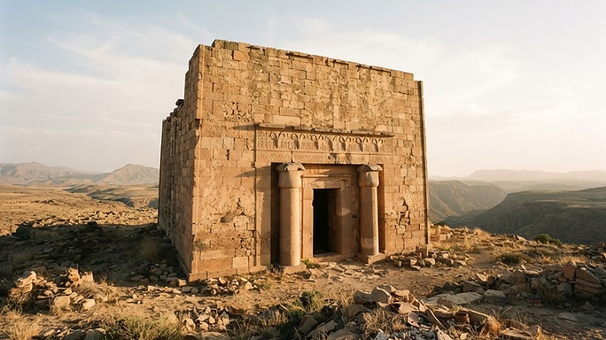
The Great Temple of Yeha, raised in dressed stone laid without mortar around 700 BCE and still standing — the oldest building in the region, its walls once crowned by a frieze of carved ibex.
For a century scholars argued over what D'mt really was. The inscriptions are in the South Arabian script, the temples follow South Arabian plans, and the god honoured in them — the moon god Ilmuqah — came from across the sea. Yet the farming, the burials and the people were African. Modern excavation has tended to read D'mt not as a colony planted from Arabia but as an indigenous highland kingdom that traded with Arabian partners and absorbed their writing, their architecture and their gods. Out of that borrowed script came the letter forms of Ge'ez — the alphabet the highlands still write with today.
By the fifth century BCE the inscriptions thin out, and then stop. The causes are debated: a growing population straining the plateau's soils and forests, a shift in the trade the kingdom depended on, or simply the rise of rivals. What is clear is where power went. The highland towns of Matara and Qohaito grew, and to the south the settlement at Aksum began its long ascent through the Proto-Aksumite centuries. When a Greek sailor wrote of this coast six hundred years later, the kingdom he named was Aksum — and the port he described was Adulis, older than the state that used it.
Part two · Adulis, the emporium
The Periplus of the Erythraean Sea, a Greek merchant's guide to Red Sea navigation, describes Adulis as a port established by law — a regulated harbour with rules, not a beach where anyone could run a boat ashore. Its customs house stood at Gabaza on the shore, where the goods of the African interior met the ships of Egypt, Arabia and India. From the quay a road ran inland to the capital at Aksum, and the trading year turned with the monsoon winds: fleets sailed on the seasons or not at all. The Periplus names the ruler of the region around the port, Zoskales, the only king of the country between the Sudanese coast and the rest of Barbaria — a miserly man, but otherwise upright and educated in Greek.
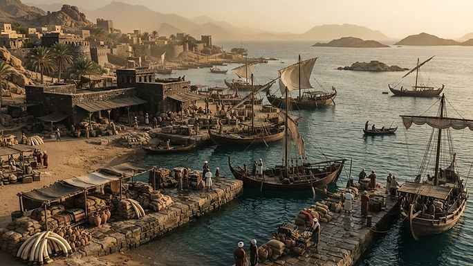
The harbour in its sixth-century heyday: quays, square-sailed merchantmen, and the ivory, tortoiseshell and rhinoceros horn that made the port's name.
Two inscriptions stood at Adulis, and both survive only because a traveller copied them. The first, cut in Greek, recorded the campaigns of Ptolemy III Euergetes of Egypt into Asia in the 240s BCE. The second, carved on a marble throne, set out the conquests of an African king whose name was already unreadable in the sixth century. Cosmas Indicopleustes, the Alexandrian merchant who transcribed them around 525 CE, noted that criminals were executed before the throne, and that Emperor Kaleb had the stone copied before he sailed across the sea. That expedition was Adulis at its height — a fleet of more than sixty ships and tens of thousands of men, launched from the harbour for Himyar in southern Arabia. Whether the port was merely Aksum's outlet to the world or a power in its own right is still argued, for Adulis long predates the empire whose ships it served.
Adulis was sacked by raiders around 640 CE and abandoned as Aksum faded. Silt and time took the rest, and the city vanished beneath the coastal plain. Excavators worked the site in 1907 and uncovered a basilica and monumental masonry; fieldwork continues today, season by season, and has recovered ceramics spanning fifteen hundred to one hundred BCE — proof of a harbour far older than any of the kingdoms it served. The argument over Adulis will not be settled until more of the buried city is lifted out of the ground.
At a glance
D'mt
The first kingdom named in the highland record, its name carved by scribes on both sides of the Red Sea.
Yeha · c. 700 BCE
A temple of dressed stone laid without mortar — the oldest standing building in the region.
Adulis · the law of the port
A regulated harbour whose customs house at Gabaza stood where the inland road met the sea.
Adulis · c. 525 CE
More than sixty ships and tens of thousands of men sailed from here for southern Arabia.
The archive on film
Two documentaries carry the story forward: one from the excavation trenches at Buya in the Northern Red Sea region, where a million-year-old cranium was lifted from the sediment, and one from the geneticists' laboratory, reading the ancestry written into Eritrean DNA.
 Watch the film · 17 min
Filmed with Eritrea's Commission of Culture & Sport, the Museum of the Northern Red Sea and a team of Italian researchers, the documentary follows the excavations at Buya on the Great Rift Valley — a landscape that was once a broad lake, its edges crowded with hippopotamus, elephant, antelope and crocodile. The beds have yielded Acheulean stone tools, six human footprints some 800,000 years old, and a complete one-million-year-old cranium, UA 31, bearing traits of both Homo erectus and Homo sapiens. The excavators argue the fossil pushes back the emergence of modern human morphology by roughly 300,000 years.
Film courtesy of Eritrea Embassy Media · opens on YouTube
 Watch the film · 18 min
Ancient DNA has opened a new chapter in Eritrea's story. Studies of genomes from the Horn of Africa disagree sharply on when non-African ancestry entered the region: one school dates it to a West Eurasian back-flow of about 3,000 years ago, while another traces a far older 'Ethio-Somali' lineage back more than 23,000 years, and a 4,500-year-old genome from a cave at Mota shows what the highlands looked like before the later wave. The film follows that evidence through Eritrea's nine recognised ethnic groups and the Red Sea crossings that shaped them, and asks whether the old formula of 'African and Arab' was ever true.
Film courtesy of DNA Legacy · opens on YouTube
The Chronicle Examined
Six questions on the eras you just travelled through — from obsidian toolmakers to the medieval Red Sea. See how much of the chronicle you carry.
The Trade Winds
The civilization of ancient Eritrea was never landlocked. Caravans carried goods down the escarpment to Adulis, where fleets sailed for Egypt, Arabia, India and Rome. Select a site on the map to see its photograph and story.
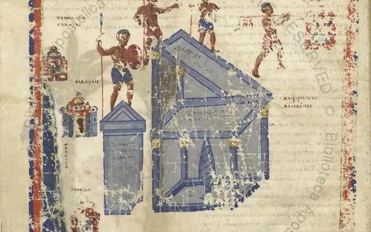
Gulf of Zula · 1st c. BCE – 7th c. CE
Eritrea's great ancient port on the Gulf of Zula, its harbour known as Gabaza. Its name is contested: folklore holds that 'Adulis' means 'free people' — fugitives from ancient Egyptian lords who settled on its shore — while Greek Ἄδουλις has been read as 'place without slaves', and in Saho it is ado lay, 'clear water'. Greek writers such as Agatharchides first knew it as a small village of hunters clad in animal hides and armed with spears and staves. Once Egypt and Greece learned of the harbour it grew into a major Red Sea emporium, exporting animals, ivory and minerals and importing jewellery and goods from Egypt — its elephants prized by the pharaohs for war. Under the Roman Empire its trade deepened, and with the rise of Aksum it became the maritime gateway joining that kingdom to Rome, Greece, Arabia, Persia and Africa, trading as far as China for hippopotamus, turtle and elephant tusks between roughly 220 and 589 CE. Adulite merchants crossed the Bab al-Mandeb and the Persian Gulf to reach Sri Lanka, while Adulite priests travelled to Constantinople for the theological debates of the 5th century. In the early 6th century the port hosted a fleet of more than 60 ships and tens of thousands of soldiers — the launch point for Emperor Kaleb's expedition into Himyar. The port's exports were drawn from the African interior. The Periplus of the Erythraean Sea lists the goods shipped out in its day — ivory, tortoiseshell and rhinoceros horn among them, wares that Pliny the Elder had already noted in the Roman market. The trading year was ruled by the monsoon: the primary season for exports at Adulis and its surrounding region ran from January to September, the months when the winds carried fleets between the Red Sea, Arabia and India. Long before the Ptolemaic era the site reaches back into the Land of Punt: obsidian samples and the genetic tracing of baboons link Adulis to that fabled trading world, suggesting it may have been one of Punt's key ports and pushing the harbour's origins toward the 2nd to 3rd millennium BCE. Carved alabaster slabs of the mid-1st millennium BCE — possibly parts of a stone throne — survive from this early phase. The centuries between Punt's decline and the Ptolemaic revival of Erythraean trade remain poorly known: commerce with Egypt fell away as the Egyptian state weakened in the Third Intermediate Period, and excavation at Adulis has been limited. Fieldwork is ongoing, however, and recent seasons have recovered ceramics and pottery spanning 1500 to 100 BCE. Sacked by Arab invaders around 640 CE and abandoned after the fall of Aksum, the port was swallowed by the earth. Whether Adulis was merely an Aksumite port or a power in its own right is still debated, for it long predates Aksum. Today Adulis lies buried, its relics awaiting excavation — a site of immense archaeological and touristic promise.
7 sites · All
Adulis & Matara
A close-up gallery of artifacts from the great port of Adulis and the highland settlement of Matara. Click any piece to open a zoomable view and trace the fine detail of mason and mint.
The Monolith Gallery
Each artifact is a fragment of a civilization that engineered in stone, traded in gold, and wrote its own name into history.
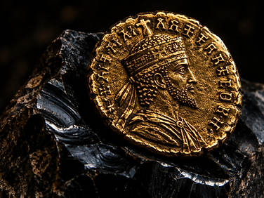 № 01
c. 4th century CE · Gold
Aksum was the first sub-Saharan state to mint its own coinage. Gold, silver and bronze issues bore the name of the king in Ge'ez — a currency fit for trade with Rome and India.
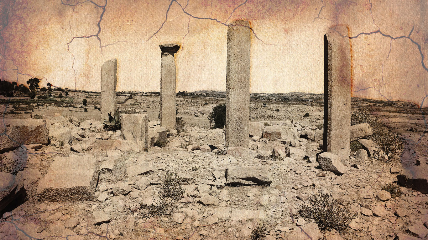 № 02
Highland trading post · between Adulis and Aksum
Perched on the highland plateau, Qohaito served as a trading post between the port of Adulis and the interior city of Aksum. Temple ruins still stand among the pre-Aksumite dam systems and rock art of the plateau.
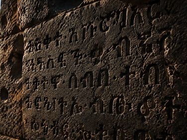 № 03
Basalt · c. 4th century CE
The Ge'ez script, descended from South Arabian letters, became the written voice of an empire. Carved into stone, it recorded laws, victories and the conversion of a kingdom.
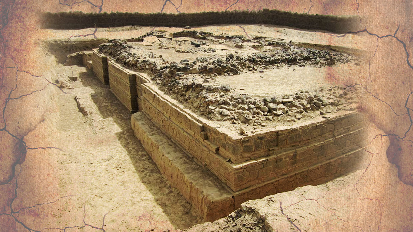 № 04
Gulf of Zula · 5th-century basilica ruins
Adulis on the Gulf of Zula was documented in the 1st-century Periplus of the Erythraean Sea. Romans, Arabs and Indian merchants all passed through its harbour. Excavations have uncovered warehouses, temples and the ruins of a 5th-century Byzantine basilica.
The Living Script
From Sinai pictographs to a syllabary still spoken today — trace the lineage of a script that crossed the Red Sea and never stopped writing. Hover a character to hear its sound and meet its modern English echo.
c. 1800 BCE
Sinai miners carve pictographs for a Canaanite consonantary — the seed of every alphabet west of India.
c. 1000 BCE
Sabaean traders carry a consonantal abjad across the Red Sea into the Eritrean highlands.
c. 500 BCE
Highland scribes adapt the abjad to local languages, inscribing stelae at Yeha and Matara.
c. 300 CE
Vowel markers fold onto each consonant, turning letters into syllables — the fidel system is born.
Today
Ge'ez still sounds in liturgy and writes Tigrinya, Tigre and Amharic for millions.
First-order syllables · hover to read
Hover a character to reveal its sound and its modern English equivalent.
Ge'ez is an abugida — each fidel marks a consonant with a built-in vowel
The Mother of Letters
Around 1800 BCE, Canaanite-speaking workers in Egypt's turquoise mines at Serabit el-Khadim scratched short texts into the rock — and in them, for the first time, a small set of pictures stood for sounds rather than things. Found there and along the desert road at Wadi el-Hol, this is the oldest alphabetic writing known: some two dozen signs, the ancestor of the letters used across the world today and, through the South Arabian abjad, of Ge'ez itself.
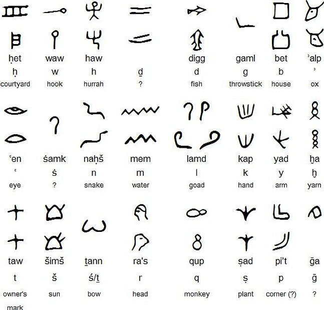
The sign corpus — pictograph, name, sound and the object it depicts
A miner drew a house, and readers heard the first sound of the word for house — bet. The picture stopped meaning the thing and started meaning the sound, and the letter b was born.
The script wrote consonants and left the vowels to the reader. It is an abjad, not yet an alphabet in the Greek sense — the same habit that shaped the South Arabian and Ge'ez scripts.
Where Egyptian writing needed hundreds of signs, this one needed about twenty-four. That economy is what let the alphabet travel, and why it outlived the empires that used it.
The alphabetic idea went both ways. Its Phoenician branch carried the letters to Greece and Rome; its southern branch — the South Arabian abjad — crossed the Red Sea and was reshaped in the Eritrean highlands into Ge'ez.
Visitor Voices
Have you walked among the stelae of Matara or stood at the harbour of Adulis? Add your photograph or story to the archive and help others see these places through visitor eyes.
The archive awaits
Be the first to add a photo or story.
Footnotes
Every claim in this archive is traced back to the scholarship and primary sources behind it — excavation reports, ancient texts and the studies that read them. 81 references in all.
The Linguistic Legacy
The Ge'ez language and its script, born in these highlands more than two thousand years ago, still live — in liturgy, in scholarship, and in the daily letters of millions. Few writing systems on earth can claim such an unbroken thread from antiquity to now.
The liturgical language of the Eritrean and Ethiopian Orthodox churches, descended from the tongue of Aksum.
A living language of the Eritrean highlands, written in the same Ge'ez script that once carved royal decrees.
Monolithic obelisks at Aksum and Matara — among them the largest single stones ever quarried in the ancient world.
Heritage conservation for the sites of ancient Eritrea


